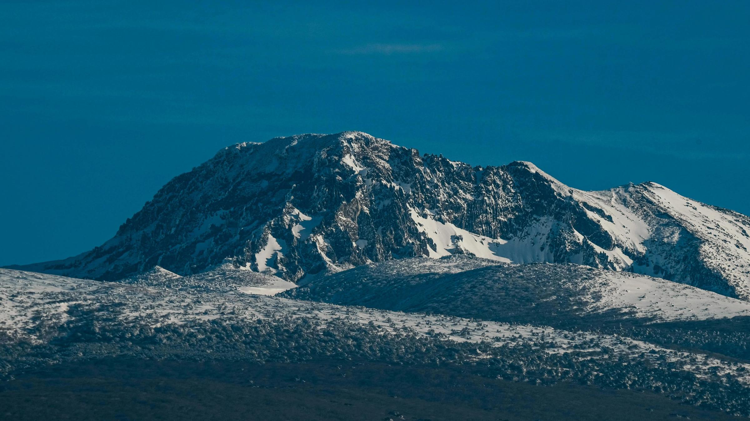
Snow-covered summit ridge of Hallasan under a deep blue winter sky, Jeju Island
Jeju Island

Hallasan

9.6 kmStrenuous Permit

Photo by insung yoon on UnsplashUnsplash License

Hallasan is the highest mountain in South Korea, and the volcano that built Jeju Island. Its summit reaches 1,947 meters, and just below the highest point sits Baengnokdam, a crater lake in the summit caldera. The mountain also carries a layered set of UNESCO recognitions on Jeju: Hallasan National Park forms part of the core area of the Jeju Island Biosphere Reserve, the Hallasan Natural Reserve is a component of the "Jeju Volcanic Island and Lava Tubes" World Heritage property, and Hallasan is a geosite within the island-wide Jeju Island UNESCO Global Geopark. Planning a Hallasan hike, though, is less about the view than the logistics: of its five main trails, only two reach the summit, both need a reservation for their upper section, and every trail closes its gate at a set time. The reservation rules, gate times and how to reach each trailhead are all set out below.

Safety

A reservation is required only for the summit sections of the Seongpanak (Jindallaebat–Baengnokdam) and Gwaneumsa (Samgakbong–Baengnokdam) trails. The lower sections of both trails and the Yeongsil, Eorimok and Donnaeko trails can be hiked without one.

한라산국립공원 탐방예약 구간 조정 관련 안내 (2025-04-23)

Scheduled restriction: the Samgakbong–Baengnokdam summit section of the Gwaneumsa trail is planned to be closed from 1 August to 30 September 2026 for trail works. During this period the summit is reachable only via the Seongpanak trail; the Gwaneumsa trail remains open up to the Samgakbong shelter without a reservation.

관음사 탐방로 예약 제한 안내 — 삼각봉~백록담 구간 통제 (2026-06-19)

Routes

Seongpanak TrailPrimary
Reaches summit
Moderate
To summit
9.6 km
Time
4 h 30 m
Permit · 1,000/day Seasonal cutoff applies

Seongpanak is the longer, more gradual route to Baengnokdam, climbing through forest to the Jindallaebat shelter before an open final ridge to the crater rim. The summit section beyond Jindallaebat needs a reservation and an early start.

Official rules
Reservation QR

Booking window: Opens at 09:00 KST on the first business day of each month, for the following month

Reservation site

The section from the Jindallaebat shelter to the Baengnokdam summit requires a reservation; the lower section is open without one.

Trail entranceWinter (Oct–Mar)11:30 KSTNo entry past this time.
Trail entranceSummer (Apr–Sep)12:30 KSTNo entry past this time.
Jindallaebat checkpointWinter (Oct–Mar)11:30 KSTNo ascent to the summit section past this time.
Jindallaebat checkpointSummer (Apr–Sep)12:30 KSTNo ascent to the summit section past this time.
Baengnokdam summit (start of descent)Winter (Oct–Mar)13:30 KSTBegin descending from the summit by this time.
Baengnokdam summit (start of descent)Summer (Apr–Sep)14:30 KSTBegin descending from the summit by this time.
Missed reservation
One missed reservation without cancellation: new reservations blocked for 3 months
Repeat
Two missed reservations: new reservations blocked for 1 year
Source: 한라산국립공원 탐방예약시간 조정 관련 안내 (2025-10-24, 시행 2025-12-01)
Gwaneumsa Trail
Reaches summit
Strenuous
To summit
8.7 km
Time
5 h
Permit · 500/day Seasonal cutoff applies

Gwaneumsa follows the Tamna Valley to the Samgakbong shelter and then climbs steadily to the crater rim. It is shorter than Seongpanak but gains more height, and the summit section beyond Samgakbong needs a reservation, so start early.

Official rules
Reservation QR

Booking window: Opens at 09:00 KST on the first business day of each month, for the following month

Reservation site

The section from the Samgakbong shelter to the summit requires a reservation; the trail up to Samgakbong is open without one.

Trail entranceWinter (Oct–Mar)11:30 KSTNo entry past this time.
Trail entranceSummer (Apr–Sep)12:30 KSTNo entry past this time.
Samgakbong shelterWinter (Oct–Mar)11:30 KSTNo ascent to the summit section past this time.
Samgakbong shelterSummer (Apr–Sep)12:30 KSTNo ascent to the summit section past this time.
Baengnokdam summit (start of descent)Winter (Oct–Mar)13:30 KSTBegin descending from the summit by this time.
Baengnokdam summit (start of descent)Summer (Apr–Sep)14:30 KSTBegin descending from the summit by this time.
Missed reservation
One missed reservation without cancellation: new reservations blocked for 3 months
Repeat
Two missed reservations: new reservations blocked for 1 year
Source: 한라산국립공원 탐방예약시간 조정 관련 안내 (2025-10-24, 시행 2025-12-01)
Yeongsil Trail
Turns around at Nambyeok Junction (1,600 m)
Moderate
One way
5.8 km
Time
2 h 30 m–3 h 15 m
Seasonal cutoff applies

Yeongsil passes the rock spires of Yeongsil into the high meadows around Witse-oreum and ends at the Nambyeok Junction below the summit wall. Baengnokdam cannot be reached from this side, so plan the junction as your turnaround.

Official rules
Trail entranceWinter (Oct–Mar)12:00 KSTNo entry past this time.
Trail entranceSummer (Apr–Sep)15:00 KSTNo entry past this time.
Witse-oreum control point (toward Nambyeok Junction)Winter (Oct–Mar)13:00 KSTNo passage toward the Nambyeok Junction past this time.
Witse-oreum control point (toward Nambyeok Junction)Summer (Apr–Sep)14:00 KSTNo passage toward the Nambyeok Junction past this time.
Source: 한라산국립공원 탐방객 출입(입·하산) 제한 시간 변경공고 (2024-02-22)
Eorimok Trail
Turns around at Nambyeok Junction (1,600 m)
Moderate
One way
6.8 km
Time
3 h
Seasonal cutoff applies

Eorimok climbs steadily through forest onto the open Witse-oreum plateau and continues to the Nambyeok Junction. The trail does not reach Baengnokdam; official guidance sends hikers down by the Yeongsil or Donnaeko trails instead.

Official rules
Trail entranceWinter (Oct–Mar)12:00 KSTNo entry past this time.
Trail entranceSummer (Apr–Sep)15:00 KSTNo entry past this time.
Witse-oreum control point (toward Nambyeok Junction)Winter (Oct–Mar)13:00 KSTNo passage toward the Nambyeok Junction past this time.
Witse-oreum control point (toward Nambyeok Junction)Summer (Apr–Sep)14:00 KSTNo passage toward the Nambyeok Junction past this time.
Source: 한라산국립공원 탐방객 출입(입·하산) 제한 시간 변경공고 (2024-02-22)
Donnaeko Trail
Turns around at Nambyeok Junction (1,600 m)
Moderate
One way
7 km
Time
3 h 30 m
Seasonal cutoff applies

Donnaeko is the southern approach, threading deep forest to the Nambyeok Junction beneath the summit's south wall. Baengnokdam is not accessible here, and its gate closes earlier than the other routes, so start as early as you can.

Official rules
Trail entranceWinter (Oct–Mar)10:00 KSTNo entry past this time.
Trail entranceSummer (Apr–Sep)11:00 KSTNo entry past this time.
Source: 한라산국립공원 탐방객 출입(입·하산) 제한 시간 변경공고 (2024-02-22)

Getting there

Hallasan rises at the center of Jeju Island. Most visitors arrive through Jeju International Airport, then reach each trailhead from Jeju City by intercity bus, taxi or rental car; see the trailhead list below for bus routes.

Seongpanak Trailhead
Route 281 (Jeju Bus Terminal–5.16 Road–Seogwipo); express routes 181 and 182 also serve the 5.16 Road
Bus OK
Gwaneumsa Trailhead
Route 475 (Jeju National University–Gwaneumsa loop); transfer from route 281
Bus OK
Yeongsil Trailhead
Intercity route 240 via the 1100 Road · 50 min
Bus OK
Eorimok Trailhead
Intercity route 240 via the 1100 Road; about a 15-minute walk from the Eorimok entrance stop · 35 min
Bus OK
Donnaeko Trailhead
Intercity bus toward Seogwipo on the 5.16 Road; alight at the Seogwipo Science High School entrance, then about a 1-hour walk to the Donnaeko trail office · 50 min by bus
Bus OK
Source: 제주국제공항 — Visit Jeju

Course overview

Route overview · reference only
Primary route
Seongpanak Trail
9.6 km4 h 30 m
Routes on this mountain
  • Seongpanak TrailPrimary
  • Gwaneumsa Trail
  • Yeongsil Trail
  • Eorimok Trail
  • Donnaeko Trail

Course overview · reference only — a schematic of the routes, not an actual navigation route or GPS track.

Which Hallasan trail should you choose?

Start with one decision: the summit, or a shorter day in the high country. Only Seongpanak and Gwaneumsa reach Baengnokdam, and only their upper, summit-bound sections need a reservation. Yeongsil, Eorimok and Donnaeko climb to the Witse-oreum plateau and end at the Nambyeok Junction, about 1,600 meters below the south wall — no summit, and no reservation. The route cards above carry each trail's exact distance, time and difficulty, so use this section to pick the right trail rather than to compare the numbers.

The two summit trails are long, weather-exposed days; the three lower trails are the practical choice without a reservation slot, on a tighter schedule, or when the summit is closed. Distances shown on the route cards are one-way. On most trails you return the way you came, but the two summit trails join at the top, so you can go up Seongpanak and come down Gwaneumsa, and the three lower trails connect on the plateau for a Yeongsil–Eorimok crossing. If you finish at a different trailhead from where you started, arrange your return transport in advance, because the trailheads sit on different sides of the mountain.

The two summit trails: Seongpanak and Gwaneumsa

Seongpanak is the longer, more gradual line to the top, rising through forest to the Jindallaebat shelter before an open final ridge. Gwaneumsa is shorter but climbs harder, following the Tamna Valley to the Samgakbong shelter and gaining more height for the distance. On both, the reservation and the strict checkpoint cutoffs apply only to the summit section beyond the shelter — the lower stretch is open without one.

At the top is Baengnokdam, a crater lake inside the summit caldera; the summit itself stands at 1,947 meters. The rim is exposed and ecologically sensitive, so stay behind the rope lines and carry everything out. Do not count on resupply along the way: Seongpanak has no shop on the trail, Gwaneumsa has only a rest kiosk at the entrance, and the spring on the Eorimok side can run dry — carry enough water and food from the start.
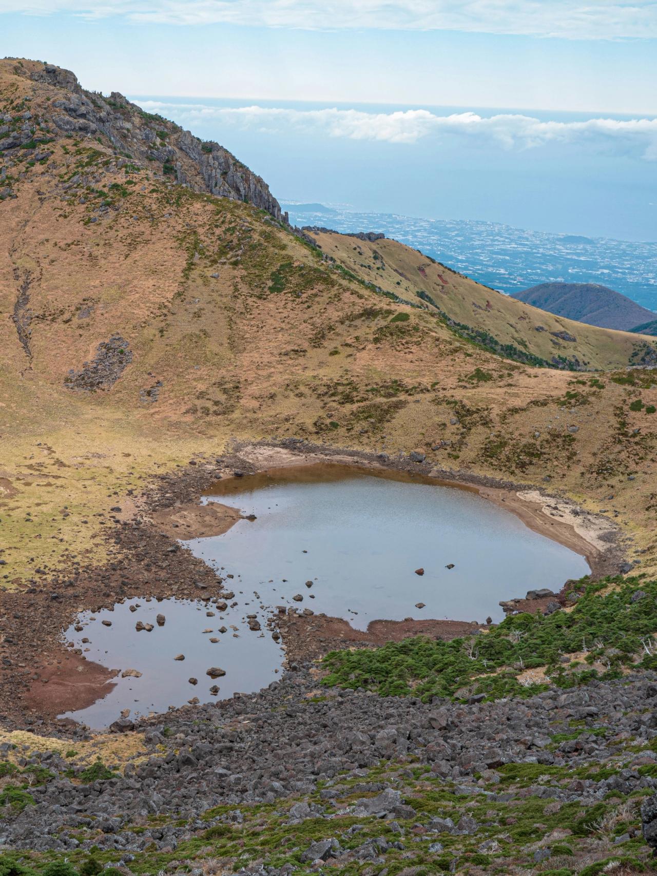
Baengnokdam crater lake in the Hallasan summit caldera, with Jeju's coastline beyond
Photo by Sung Jin Cho on Unsplash · Unsplash License

Before you commit to Gwaneumsa, check the official notices for seasonal closures. As a current, dated example, the Samgakbong–Baengnokdam section of Gwaneumsa is scheduled to close from 1 August to 30 September 2026; in that window the summit is reachable only by Seongpanak, while Gwaneumsa stays open up to the Samgakbong shelter without a reservation. Dates like these change from year to year, so treat the park's notice board as the source of truth.

The three trails below the summit: Yeongsil, Eorimok and Donnaeko

None of these three reaches Baengnokdam; all end at the Nambyeok Junction, about 1,600 meters, beneath the summit's south wall, and none needs a reservation. Yeongsil passes the Yeongsil rock spires and opens onto the Witse-oreum meadows, where royal azalea blooms in late spring; from the ticket booth the final stretch to the trailhead is about a 45-minute walk, so give yourself time. Eorimok climbs through forest past the Sajebi and Manse hills to the Witse-oreum shelter and on to the same junction, and it pairs naturally with Yeongsil for a plateau crossing. Donnaeko is the southern approach, reaching the junction from the Seogwipo side; its entry gate closes earlier than the others, so it needs the earliest start of the five.

When the summit trails are closed, these routes may still be open, but that is not automatic — check each trail's open status on the official site before you rely on it.
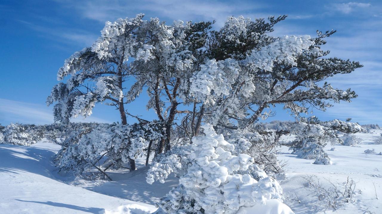
A tree encased in rime ice on Hallasan's snow-covered high plateau
Photo by Ji Seongkwang on Unsplash · Unsplash License

Reservations, cutoff times and no-show rules

These are the rules that most guides get wrong, so here they are from the park's official notices, checked on 22 July 2026.

There is no general park permit.

Booking opens at 09:00 on the first business day of each month for the following month, and stays open through that month's end. One booking covers up to four people, once per week; once you have used your trail code for a hike, your weekly count resets and you can book again the next day.

Booking is free, through the official Hallasan reservation site.

  1. 1At the entrance, rangers check that your reservation QR code matches your ID. If they do not match, entry is denied and a one-year entry restriction applies; reselling a QR code cancels the reservation and also carries a one-year entry restriction.
  2. 2A no-show without cancellation blocks new reservations for three months, and a second for one year.

The cutoffs are a safety rule, not a formality, and they differ by trail, checkpoint and season.

Miss a cutoff and rangers turn you back, so build your plan around passing the checkpoint on time.

When to hike Hallasan

The park runs on two control seasons — winter (October–March) and summer (April–September) — and every trail opens at 05:00, with earlier cutoffs in winter. Late spring brings royal azalea on the Witse-oreum slopes, and autumn brings foliage on the high trails. In winter the summit routes become snow hikes and can close for wind and heavy snow, so carry crampons and windproof, waterproof layers. Whatever the month, the park may close trails, fully or in part, when the Korea Meteorological Administration issues weather advisories or warnings — check the official site the evening before and again on the morning of your hike.
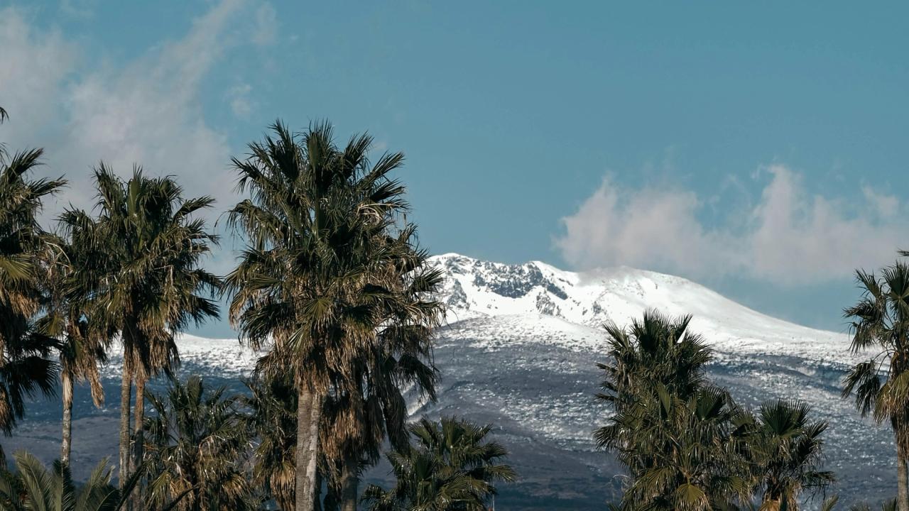
Snow-capped Hallasan rising beyond palm trees on Jeju's lowlands in winter
Photo by insung yoon on Unsplash · Unsplash License

Getting there and parking

Most visitors reach Jeju by air, into Jeju International Airport, though ferries also run from several mainland ports. From there you reach the trailheads by bus, taxi or rental car, and the routes differ by direction, so check the departure point as well as the number.

  • Seongpanak: Bus 281 runs the 5.16 Road, reaching Seongpanak in about 45 minutes from the Jeju bus terminal or about 50 minutes from the Seogwipo terminal in the other direction. Express 181 leaves Jeju International Airport toward Seogwipo and reaches Seongpanak in about 35 minutes, while express 182 runs the opposite way from the Seogwipo World Cup Stadium in about 45 minutes. The Seongpanak lot holds 156 vehicles; when it fills, there is a free 199-space transfer lot on the 5.16 Road near Jeju International University. Because the lot fills early, the park recommends public transport.
  • Gwaneumsa: The official notices list no single trailhead bus from central Jeju City; the official route is to reach Jeju National University and transfer to bus 475. Confirm the schedule on the day.
  • Eorimok: Intercity bus 240 runs the 1100 Road; it is about 35 minutes from the Jeju bus terminal, then about a 10-minute walk from the stop.
  • Yeongsil: The same bus 240 toward Jungmun reaches the Yeongsil area in about 50 minutes; from the Yeongsil ticket booth it is about a 45-minute walk up to the trailhead.
  • Donnaeko: From the Jeju bus terminal, take a 5.16 Road bus toward Seogwipo and get off at the Seogwipo Science High School entrance, about 50 minutes, then walk about an hour to the Donnaeko trail office.

Bus timetables are set around the park's opening and closing times and change seasonally, so check the Jeju bus information system before an early start. A rental car adds flexibility for the pre-dawn schedule, but Seongpanak parking is limited, which is why the park points hikers to public transport and the transfer lot.

Safety and etiquette

Weather is the defining risk: conditions on the exposed upper mountain can change quickly, with strong wind, rain or sudden snow at altitude, so carry warm and waterproof layers year-round and turn back if the weather closes in — the cutoff system exists for exactly this reason. Keep to the designated trails; the endemic Korean fir forest on the upper slopes is protected, and damaging the environment or leaving the marked route can bring penalties under the relevant regulations. Pack out all waste, light no fires, and give way to hikers coming uphill. Carry a charged phone, tell someone your route and expected return time, and note the location markers along the trail. In an emergency, call 119 for fire and rescue, or contact the Hallasan National Park office.
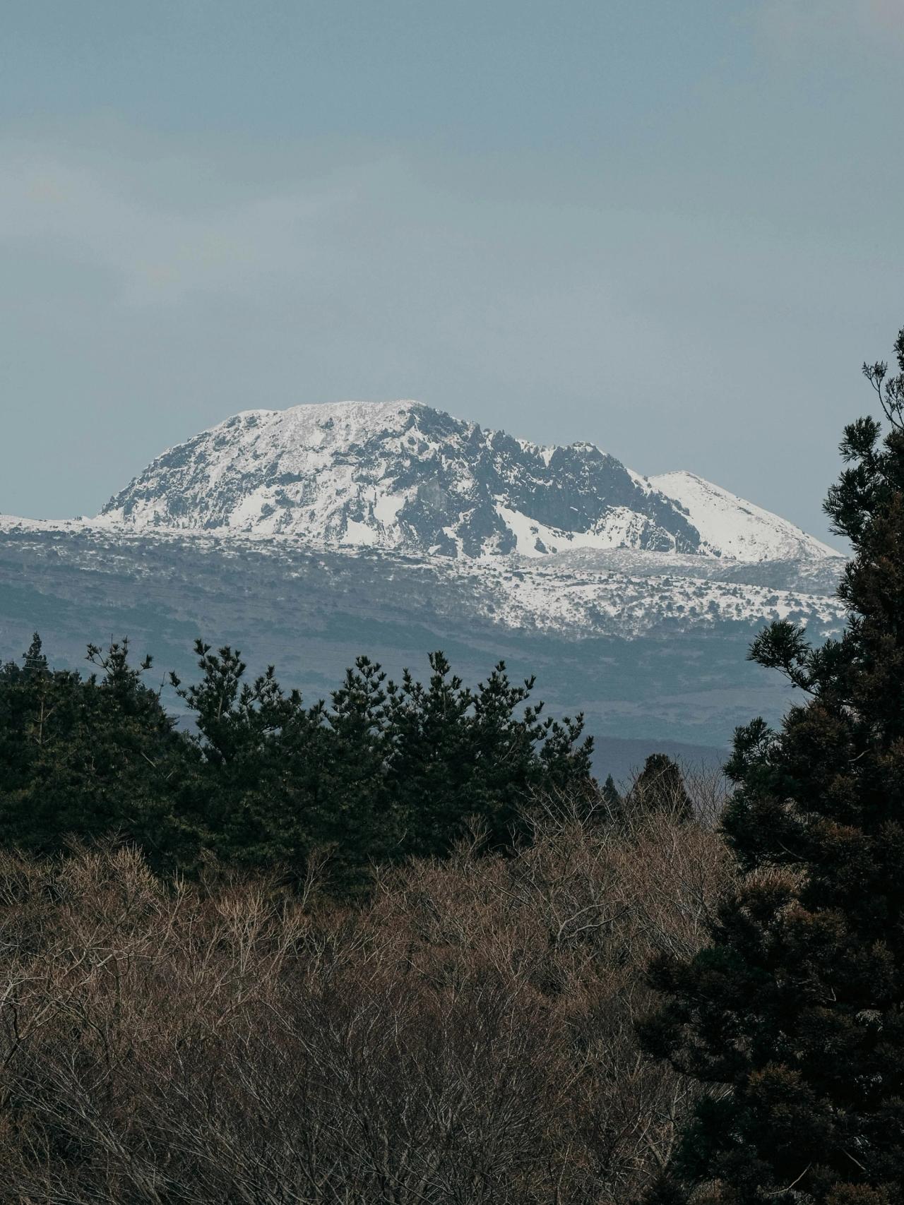
The snow line on Hallasan's upper slopes above winter forest under overcast skies
Photo by insung yoon on Unsplash · Unsplash License

Hallasan rewards planning and fitness in equal measure: it is a long day on a high, weather-exposed mountain, and the reservation and cutoff system is unforgiving of a late start. Book the summit section as soon as the window opens, be at the gate by opening, watch the cutoffs and the forecast, and choose the trail that fits your day. Do that, and Jeju's volcano gives you one of the best hikes in Korea — crater rim or high meadow, whichever you came for.

FAQ

Where is Hallasan, and how high is it?

Hallasan sits at the center of Jeju Island, off the south coast of South Korea, and its summit is 1,947 meters — the highest point in the country.

Do I need a permit or reservation to hike Hallasan?

There is no general park permit, but the two summit trails need a reservation for their upper sections: Jindallaebat–Baengnokdam on Seongpanak and Samgakbong–Baengnokdam on Gwaneumsa. Yeongsil, Eorimok and Donnaeko need none.

Which Hallasan trails reach Baengnokdam?

Only Seongpanak and Gwaneumsa. Yeongsil, Eorimok and Donnaeko end at the Witse-oreum area and the Nambyeok Junction below the summit.

When do Hallasan reservations open?

At 09:00 on the first business day of each month, for the following month, and they stay open through that month's end.

What are the Hallasan cutoff times?

Every trail opens at 05:00, and the times differ by trail and season. The summit trails close the entrance and shelter checkpoint at 12:30 in summer and 11:30 in winter; Yeongsil and Eorimok close later, and Donnaeko earliest of all. Check the route cards for each checkpoint.

How long does a Hallasan summit hike take?

Plan a full day for a summit round trip on Seongpanak or Gwaneumsa, and pace yourself to the cutoffs; the route cards list the official one-way times.

Can I hike Hallasan in winter?

Yes, but bring crampons and windproof, waterproof layers and watch the forecast — summit routes close for snow and wind.

Sources & last reviewed · 20 sources

Last reviewed 2026-07-22